Onde tropicale avec 90% de chance de se transformer en cyclone
Dernière activité 19 Octobre 2016 par Priscilla
4717 Vues
125 réponses
Abonnez-vous a cette discussion
Nouvelle discussion
Cette onde tropicale, qui passera au sud de l'arc antillais, a de fortes chances de se transformer en cyclone et pourrait nous concerner sous peu. Un avion spécialisé doit jauger plus précisément la menace dans l'après-midi. 
1. Showers and thunderstorms continue in association with a
well-organized tropical wave located about 475 miles east-southeast
of Barbados. However, the low appears to lack a closed circulation
at this time. Environmental conditions are favorable for continued
development, and a tropical depression or tropical storm could form
later today or tonight while the system moves westward to west-
northwestward at 15 to 20 mph. Interests in the eastern and central
Caribbean Sea, including the northern coast of South America, should
monitor the progress of this disturbance, since warnings and watches
could be required at any time. Regardless of whether the system is a
tropical wave or tropical cyclone, heavy rains and wind gusts to
tropical storm force are expected to spread over the Windward
Islands and portions of the southern Lesser Antilles, beginning
tonight and continuing into Wednesday. An Air Force Reserve
reconnaissance aircraft is scheduled to investigate the disturbance
this afternoon.
* Formation chance through 48 hours...high...90 percent
* Formation chance through 5 days...high...90 percent
Pou lala :-( merci pour l'avertissement
Bonjour Robinson.
Oui, effectivement, je suis attentivement l'évolution des dépressions depuis l'Afrique et celle ci en particulier, puisque sa marge de progression, d'une part, pour un éventuel passage en cyclone, et d'autre part, par la zone de mouvement qui va passer près de chez nous.
Ce qui m'étonne, c'est le peu de cas qu'en font les autorités. Donc on peut penser que ce ne sera pas un problème majeur.
Mais tu as raison Robinson, un homme averti en vaut 2.
Cordialement
Salut Pierre,
Pour le moment ce n'est qu'une onde tropicale, mais vu la chaleur qu'il fait ces jours-ci, elle ne peut que se renforcer dans les jours qui viennent. La Martinique est déjà en vigilance jaune. Par contre sa trajectoire fait qu'elle a de bonne chance de nous concerner car souvent les dépressions prennent une orientation nord ouest plus marquée une fois qu'elles sont dans la mer des caraibes. Ceux qui ont des travaux de toiture en cours doivent prendre en compte la probabilité de précipitations et vents violents ce week-end.
Bonjour Robinson 972.
" Ceux qui ont des travaux de toiture en cours ". On a du bol, on vient juste de terminer la pose du toit de notre maison de Jarabacoa.
Mais c'est bien connu, les montagnes arrêtent tout, tout comme le nuage de Tchernobyl s'était arrêté à la frontière française.
Cordialement
Je pensais que tu n'en étais qu'aux fondations! L'avantage des constructions ici c'est qu'elles ont le plus souvent une dalle qui sert de toit. Vu les problèmes d’étanchéité et la pluviosité de nos îles ( DOM), nous préférons les toitures en tôles ou en tuiles à tel point qu'il est conseillé de faire dalle anticyclonique + charpente au dessus.
La Martinique est passée en vigilance orange. D'après le national hurricane center de Miami, l'onde tropicale montre des signes d'organisation et devrait devenir tempête tropicale à partir de cette nuit ou dans la journée de mercredi.
Pour l'instant le centre US des cyclones ne s'affole pas trop, en RD c'est de ce coté qu'ils regardent, donc pas d'affolement coté RD.
En regardant sur ce site de météo maritime on peut se faire une idée, je m'en sert pour calculer les ondes de tempête.
Pour l'instant, la hauteur max de pluie en 24h c'est 110mm ou 110 litres d'eau par m².
Le vent max relevé sur les bouées en mer 14m/s.
Le danger ce n'est pas le vent, c'est l'onde de tempête et les pluies.
Pour l'onde de tempête pour l'instant en prenant en compte les prévisions du site météo marine ce sera de 0,5 à 0,9m, pas bien méchant.
Reste la pluie, une tempête tropicale peut faire plus de dégâts qu'un cyclone, en RD ça été le cas. Maintenant il y a un système d'alerte par SMS en RD, les gens ne se font plus surprendre.
Sur mon GSM j'ai l'application Hurricance Software Pro, c'est pas mal.
On a eu des années El Niño, cette année c'est une année sans donc plus de dépressions et cyclones comme on peut voir sur ce site local en français. La cote est des USA a été bien arrosée, un anticyclone faiblard sur les Bermudes/Açores a permis aux dépressions d'aller se perdre dans l'Atlantique. Dans l'ensemble on a été gâté.
Pour l'instant la dépression est à 30-35h d'ici, il n'y a pas de feu au lac.
Pour ceux que ça intéresse la carte des inondations potentielles. Par chez moi j'ai discuté avec des anciens et j'ai essayé de retrouver des traces, c'est du potentiel, non pas de l'historique, il y a 4m d'altitude de différence entre le potentiel et l'historique.
Allez, bonne douche, quand ce sera plus précis j'en parlerai dans le voisinage, ils seront contents, enfin de la fraicheur et dès qu'il pleut fort coté enfants c'est la fête, ils sont tous dehors. En 2012, les rues étaient transformées en toboggans aquatiques.
Ce sera un test en grandeur réelle des protections que l'INRHI a installé sur le rio Nigua qui traverse la ville.

La tempête Erika qui a sévit sur la caraïbe fin Août 2015 était elle aussi "mal organisée" et pas spécialement forte. Mais la quantité d'eau déversée sur la Dominique était du jamais vu, la tempête s'étant littéralement arrêtée sur l'île!
"Il est tombé plus de 300 mm de pluie sur l'île. Au moins une vingtaine d’habitations ont été détruites dans les inondations de la rivière traversant la capitale Roseau et les glissements de terrain ont fait d’énormes dégâts, selon l'Associated Press. Ce sont 890 maisons qui ont été détruites, ou tellement endommagées qu’elles sont devenues inhabitables, dans les différentes îles et 14 291 personnes ont été laissés sans abris. Environ 80% du pays a été privé d’électricité, ainsi que d’alimentation en eau et l’aéroport international a été fermé.
Selon le premier ministre Skerrit, les dommages auraient ramené le pays 20 ans en arrière. Au total, les pertes se montèrent à 482,8 millions $US. Ceci inclut 226 millions$US aux routes et 87 millions$US à l’habitation, ce qui représente la moitié du produit intérieur brut de La Dominique."
Donc les événements passés nous démontrent comme le dit Phil que les quantités de pluies peuvent être dangereuses et, en plus, avoir un caractère imprévisible quand la tempête fait du "sur place" et est mal organisée. Le phénomène est plus complexe qu'il n'y parait car la Martinique toute proche avait reçu beaucoup moins d'eau...
Le NOAA commence a sortir ses prévisions, ça confirme la météo marine.
C'est via l'application de mon GSM que j'ai ces éléments.
Matthew est en ce moment à la Barbade sous forme de tempête tropicale.
Il ira ensuite vers l'ouest en longeant les cotes sud américaines à 200-300km.
Aux environs de Carthagène il remontera vers le nord sous forme de cyclone vers la Jamaïque.
Jusqu'à maintenant c'est la faiblesse de l'anticyclone des Bermudes qui nous a protégé, aujourd'hui c'est sa force 1028mb qui oblige la direction vers l'ouest.
Il fait déjà une belle surface, le soleil risque d'être caché quelques temps chouette un peu de fraicheur (relative la fraicheur, 27-29°).
L'oeil de Sandy était en Floride que l'on était encore sous les nuages, ça prend parfois de la place.
Le NOAA travaille avec des probabilités basées sur l'expérience et des modèles mathématiques, les cyclones sont parfois capricieux et ne supportent les vents cisaillants. Le 30 septembre ce sera plus affirmatif.
https://www.windyty.com/?18.467,-69.900,6
ce site est assez complet et nous donne une prévision sur 4/5 jours
vous positionnez la barre sur la RD, où vous habitez et en bas à gauche le curseur pour voir les prévisions à x jours.
Merci pour le lien Cathy.
Il y a deux modèles de calcul, ECMWF et GFS.
Pour les petits systèmes comme les cyclones je préfère l'ECMWF il est souvent le meilleur, GFS est meilleur pour les grands systèmes, la météo normale, les deux sont bons, il y en a d'autres plus fantaisistes car plus spécifiques à une région.
Attention quand même à la marge d'erreur pour les phénomènes cycloniques.
A 24 h : 100 à 150 kms,
à 72 h : 300-350 kms en moyenne sur les cônes d'incertitudes du NOAA.
une bonne solution est de s'inscrire sur le site http://www.sxmcyclone.com/
c'est gratuit ( on peut faire un don aux bénévoles qui le gèrent) : site très clair qui regroupe les infos des autres sites et SURTOUT vous recevez automatiquement par @mail ou SMS toutes les infos bien avant la situation cyclonique
comme le dit Phil les dernières heures sont capitales : j'ai vécu 2 cyclones avec beaucoup de dégâts à St Martin - pourtant 24h avant les prévisions étaient plutôt rassurantes
Pour ceux que cela intéresse, vous trouverez Ici un point (vitesse des vents, précipitations) sur la tempête Matthew en Martinique.
Normalement, la RD ne devrait pas être touchée directement, mais
Pour suivre "Matthew"
Ci-dessous la trajectoire prévue de Matthew:
A noter que Matthew devrait passer au stade de cyclone à partir de vendredi. Haïti semble encore une fois être sur la trajectoire.
Lors de son déplacement vers l'ouest, Matthew impactera la côte caraïbe de la RD. Des pluies sont prévues à partir de ce soir .
Merci pour toutes ces infos. Cathy j'adore le site que tu viens de me faire connaître, je viens de transmettre le lien à mon tour en particulier à mon fils je pense qu il va pouvoir intéresser ses élèves a l’école française, il est clair et pas en anglais ;-)
Ecu03 a écrit:Normalement, la RD ne devrait pas être touchée directement, mais
Pour suivre "Matthew"
Désolé, je me suis planté sur le lien... je ne ferrai plus
Je rejoins Tina, très complet ce site, en quelques clics on a tout.
Avant pour calculer les ondes de tempêtes c'était plusieurs sites, maintenant un seul. Un sérieux gain de temps et j'emploie deux méthodes différentes pour validation et j'ai toutes des données.
Re-merci Cathy.

je suis bien contente que Mathews soit parti en mer, ouf (jusqu'à la prochaine fois).
Avec l'absence d'El Niño, je m'attendais à plus de cyclones et de tempêtes que l'année dernière.
Ca été le cas, un chance que l'anticyclone des Bermudes nous à fait des bizarreries, trop faible, il permettait aux dépressions de remonter plus vite dans l'Atlantique, pour Mathiews c'est sa force excessive qui l'a fait passer plus bas. Les USA ont eu moins de chance, c'était pas trop violent mais ils se sont pris quelques douches.
Une année à cyclones et aussi à chance.
Souhaitons qu'il reste à bonne distance d'hispaniola. Les pluies annoncées ne sont pas au rendez-vous, j'espère qu'il en sera de même avec Haïti. Le cône de trajectoire prévue par la NOAA se déplace vers l'ouest et cible maintenant davantage la Jamaique et cuba. Par contre il continue de gagner en puissance...


Matthew est passé en catégorie IV, beaucoup de vols ont été annulés.
Matthew est devenu cet après-midi un ouragan majeur de classe 4 et pourrait concerner dimanche prochain la Jamaïque, Haïti, puis Cuba et les Bahamas.
"Après avoir frappé la Martinique, la Barbade, Saint Vincent, Sainte Lucie, la Guadeloupe, la tempête tropicale Matthew, poursuit donc sa route atypique et erratique en mer de Caraïbes. Les météorologues s’arrachent les cheveux tellement les prévisions de trajectoire s’avèrent difficiles face à un phénomène qui ne ressemble à aucun autre."
Trajectoire atypique surement, erratique je ne trouve pas. Mais c'est vrai qu'ils n’arrêtent pas de bouger la remontée du cône de trajectoire vers l'ouest.
Article complet
plus classique ce site, mais assez intéressant visuellement.
Cathysuite, tu as été excellente avec ton site windyty.com ne gâche pas ces excellentes informations en envoyant des liens qui ne sont que des reprises, rien vaut l'original: Urricane Center Miami NOAA
Vous avez raison, mais je trouve que les informations sont bien lisibles.
Cordialement.
Le NOAA c'est ce que j'emploie habituellement, avec le site de Cathy, en 10 minutes je calcule l'onde de tempête, hier après-midi j'ai prévenu une personne qui connait des pêcheurs de Palenque. Ce matin je suis passé voir les traces de la nuit et la hauteur de vagues, ça correspondait aux calculs.
En 4 heures je pourrais faire les endroits à risque de la cote sud d'Hispagnola. Avec le NOAA je ne sais pas le faire en un temps aussi court.
Pour l'instant le prévu colle assez bien au réalisé coté trajet, plus je teste ce site, plus il m'étonne agréablement.
Il faudrait que je récupère une bathymétrie plus précise de l'ile, en précis je n'ai que Palenque où j'ai fais des relevés en relevant des casiers à langoustes.
Lien: Haïti - FLASH : Matthew se rapproche, Haïti en vigilance rouge
L'article de "Haiti libre" reprend les tout derniers chiffres fournis par la NOAA (forces des vents, pluviométrie, ondes de tempête).
Avant hier Matthew serait passé pendant quelques heures en force 5, c'est une première parait-il pour les Antilles.
Record inquiétant, le changement climatique n'est pas sans conséquence.
Pour la cote sud d'Haïti l'onde de tempête à proximité du centre et à droite du cyclone c'est de 4m60 à 5m90 en fonction de la bathymétrie et l'orientation de la route du cyclone par rapport à la plage.
Toujours en fonction de la bathymétrie les vagues pourront atteindre de 6,5m à 11m ce qui rajoutera une surcote de 1m-1m70.
La pluie intense avec ou sans couverture végétale et arborée, c'est différent, avec Haïti qui est pelée ça fera du dégât, le peu de terre bonne pour la culture se retrouvera dans la mer où elle empoisonnera coraux et poissons.
Pas de couverture arborée à Haïti c'est son principal problème, tout problème naturel y est amplifié.
En RD avec leur couverture arborée ils doivent gérer quelques glissements de terrains normaux vu les pentes importantes et des crues, ensuite ça revient dans l'ordre.
A Haïti les dégâts se font sentir sur des années, pas d'arbres pour ralentir la pluie et diminuer son impact, pour aider à l'infiltration et maintenir la terre.
C'est pour moi la principale différence entre les deux parties de l'ile.
@ Cathy.
Il y a déjà eu du catégorie 5 en RD au moins 3 depuis qu'on les mesure. Ce ne sont pas ceux qui ont fait le plus de dégâts, c'est l'eau la plus dangereuse et des tempêtes savent y faire aussi.
Cela dit un réchauffement c'est de l'énergie en plus dans un système, il risque d'avoir plus de réactions énergiques. Des cyclones il faut de l'eau de mer de plus de 26°, s'il y a plus d'eau "chaude" il y aura plus d'occasions sur une surface plus étendue.
L'élément le plus prépondérant reste El Niño pour l'instant.
phil san cristobal a écrit:Pas de couverture arborée à Haïti c'est son principal problème, tout problème naturel y est amplifié.
En RD avec leur couverture arborée
.../...
C'est pour moi la principale différence entre les deux parties de l'ile.
Je lis sur un site dominicain profondément anti haïtien (je dirais que c'est presque sa raison d'être)
des informations préoccupantes sur la déforestation coté RD.
il y a aussi des photos et des vidéos.
Bien évidemment, la faute est rejetée sur les haïtiens
("l'information" (?) n'y est relayée que dans ce but)
(et là, il aurait du mal à trouver un lien de cause à effet avec l'homosexualité - réelle ou supposée - de l'ambassadeur américain).
fantasme ou réalité, cette déforestation ?
Les images sont quand même bien là, mais peut-être montées en épingle.
Il y a trois ans je suis tombé sur un dominicain qui avait foutu le feu sur un coteau, comme il est dit dans le code pénal, il y a pas faute si l'on a pas conscience de faire mal. C'était le cas du bonhomme, je l'ai quand même engueuler, il m'a fait courir dans la fumée l'animal, à minima on regarde s'il y a personne avant de foutre le feu.
Pour lui foutre le feu c'était une façon de nettoyer avant de faire son charbon de bois comme le faisait son père et son grand-père avant.
Le GIEC connait pas, l'érosion connait pas, la loi connait pas, il n'a pas l'impression de faire mal.
Il n'était pas haïtien mais pauvre sans beaucoup d'éducation.
Ceux qui déboisent n'ont pas toujours conscience de faire mal avec le charbon de bois. Ceux qui profitent du trafic du charbon de bois comme en Haïti le savent, c'est assez important. A Madagascar pour lutter contre le déboisement il on lancé la mode du butane plus économique que le charbon de bois.
J'ai une voisine son arepa elle le cuit au charbon de bois, elle maitrise mieux la cuisson.
Hier devant un colmado c'était domplin, la cuisson c'était au feu de bois malgré que ce soit en ville.
Un repas dans la cambrousse c'est au feu de bois, il y a des habitudes culturo-culinaires. En France il y en a encore qui ne jurent que par le cèpe de vigne.
En RD c'est pollo carbon, cerdo carbon qui ont la préférence.
Bien sûr, bien sûr.
Us et coutumes + éducation, c'est évident.
Mais il me semble que, coté dominicain, et sur ce sujet, on avait pris le taureau par les cornes.
il y a 25 / 30 ans j'avais demandé "c'est quoi", devant une espèce de guérite qui ressemblait à un contrôle douanier sans en être un.
on m'avait répondu que ce qui était contrôlé à cet endroit, c'est ce qui sortait de la foret.
Depuis lors, cette guérite je la vois se détériorer un peu plus à chaque séjour, et les contrôles ont cessé depuis bien longtemps.
et comme, par ailleurs, je lis des choses comme celles que je viens de citer, je m'interroge :
"est-ce que cet intérêt des autorités, qui constituait un point très positif en R D, serait en train de s'estomper, voire de disparaitre ?"
et je m'inquiète
car, sur ce sujet surtout, tous les exemples ont montré qu'il était bien plus facile et rapide de détruire que de reconstruire.
Bonjour Anthoine Joel.
Quand on voit la difficulté d'abattre des arbres pour construire une maison, car le medio ambiante veille, j'imagine que le pays et son gouvernement ont pris de bonnes décisions.
Nous n'avons pas pu supprimer des souches dans notre maison de Villa Mella par exemple. Cela m'a rappelé ma vieille tante à coté de Lyon qui avait des bambous qui faisaient du bruit avec le vent et qui voulait les couper. Elle n'a pas pu le faire.
Enfin, je l'ai déjà dit dans une autre discussion, le medio ambiente forestal distribue des arbres, des arbustes et des fleurs, gratuitement, à qui en fait la demande.
S'il est vrai que du coté de Haïti la situation est catastrophique, du coté République Dominicaine, par contre, le gouvernement a pris la mesure par des actes visibles et importants par leurs actions.
http://www.ambiente.gob.do/ambienterd/m … as-al-ano/
A lire cet article du début de l'année 2016
Cordialement
Si si la deforestation est inquietante dans certaines partie de la rep dom
http://hoy.com.do/grupo-jaragua-alerta- … egion-sur/http://www.grupojaragua.org.do/Bahoruco.html
Voila...le "grupo jaragua" a constitué un groupe sur facebook, tres interessant pour suivre l actualité ecologique du pays en general et du sud en particulier.
Mais on s eloigne du sujet Matthew, alors que lui se rapproche
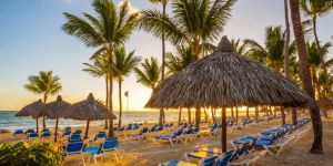
Articles pour préparer votre expatriation en République Dominicaine
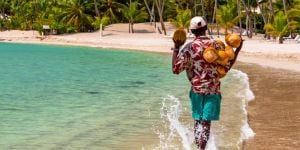 Formalités de voyage et d'entrée en République dominicaine
Avant de voyager en République dominicaine, que ce soit pour le tourisme, pour travailler, étudier ...
 Les soins de santé en République Dominicaine
Si vous vous expatriez en République dominicaine, l'une de vos principales préoccupations sera ...
 Divorcer en République dominicaine
La République dominicaine autorise différents types de divorce, dont les plus courants sont le ...
 Ouvrir un compte en banque en République dominicaine
Beaucoup de gens croient que les services bancaires en République dominicaine peuvent être ...
 Les rencontres amoureuses en République dominicaine
Comme partout ailleurs dans le monde, les gens en République dominicaine veulent trouver l'amour. Voici ...
 Travailler en République dominicaine
Si vous êtes à la recherche d'un emploi en République dominicaine, voici quelques conseils et ...
 Les impôts en République dominicaine
Il existe de nombreux types d'impôts en République dominicaine à considérer, et cet ...
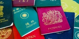 Obtenir la citoyenneté en République dominicaine
Supposons que vous en ayez assez de renouveler votre permis de séjour. Ce sera ou parce que vous voudrez ...
Elargissez votre recherche à tout le forum République Dominicaine