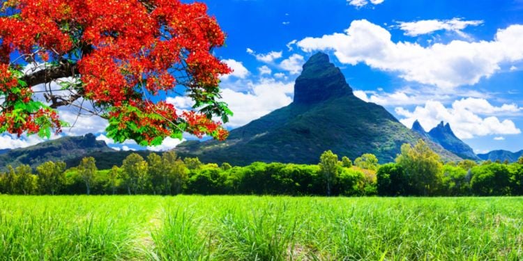
Mauritius enjoys a subtropical climate with temperatures ranging from 25 to 35°C with regular trade winds from the Southeast. Temperatures are higher during the wet season (November to April, summer in the Southern Hemisphere) and cooler during the dry season (May to October, winter).
Climate in Mauritius
 © shutterstock.com
If you're planning a move to Mauritius, you're probably wondering what the climate looks like. How many seasons are there? Should you move during the warmer or cooler season? Find the answers to your questions in this article.
In this article
The Mauritius expat guide
Updated in 2026, comprehensive and free
Read it now
Seasons in Mauritius
In summer, temperatures easily reach 30°C. However, these temperatures remain bearable, thanks to a light sea breeze in the West and a stronger wind on the East Coast. The central plateau is cooler. The diurnal amplitude in summer is 14 hours, with sunrise between 5:00 and 5:45 a.m. and sunset between 6:45 and 7 p.m. The heat accumulated during the day remains present at night.
In winter, however, temperatures between day and night can be very different. On sunny days, temperatures range from 22 to 27°C. After sunset, however, temperatures drop rapidly to 19°C near the coasts and 16°C on the central plateau. The days are shorter, lasting 11 to 12 hours. In the middle of winter, the sun rises around 6:30 a.m. and sets around 6:00 p.m. Rainfall is minimal in the coastal regions, while the central plateau receives more precipitation.
Join the Mauritius community
Get regular tips and advice to make the most of your expat life
The effects of climate change in Mauritius
The latest World Risk Report classifies Mauritius as a medium-risk country in terms of vulnerability to climate change, ranking it 104th out of 193 countries. Small islands are generally at higher risk, and Mauritius' low-lying coasts, along with its beaches and protective mangrove swamps, face the threat of submersion due to rising sea levels. The tourism industry, a key pillar of the island's economy, would face significant challenges if its pristine beaches were lost.
As highlighted by the UN Environment Program and the local Ministry of Environment, climate change is exacerbating heavy rainfall, flash floods, tropical cyclones, and droughts in Mauritius. It is normal to get tropical cyclones in the summer months, that is between November and March, but climate change is causing these cyclones to intensify more rapidly, sometimes reaching the strength of Category-5 hurricanes.
Over the past decade, natural disasters such as cyclones and tropical depressions have caused major flash floods in Port Louis and several regions of the island. Cars were swept away or submerged, and buildings and homes were affected.
Mauritius has therefore confirmed that it is particularly exposed to extreme weather events. The 2023–24 report Impacts and Consequences of Climate Change on the Republic of Mauritius highlights the country's high vulnerability to tropical cyclones and rising sea levels.
In 2022, the Ministry of Environment adopted a ten-year climate change policy (Master Plan) aimed at making the island state more resilient to natural disasters and the impacts of climate change, notably through targets for emissions reduction, energy diversification, and the strengthening of adaptation infrastructure.
Climate change is disrupting rainfall patterns, leading to erratic periods of intense rainfall followed by drought. This has resulted in periodic water cuts in some regions of the island over the last few years. If your area of Mauritius experiences occasional water cuts, it is wise to have a backup plan, such as storing bottled water during droughts.
Residents of beachside villas should ensure their properties are protected from erosion and waves, for example, by planting vegetation or installing jetties. Rising temperatures are also impacting coral reefs and fostering the proliferation of viruses, parasites and diseases. This presents an additional challenge for the island to address.
Cyclones in Mauritius
Between January and April, high temperatures, high humidity and an unstable atmosphere can lead to the development of tropical depressions. Ocean temperatures above 26°C at depth (about 28/29°C at the surface) are favorable to the formation of tropical depressions. The high temperature produces intense evaporation and moisture transfers from the ocean to the atmosphere. The state of the air mass and the wind circulation will be the final conditions for the development of the tropical depression.
Cyclone alert system
In the Indian Ocean, cyclones range from tropical storms to intense tropical cyclones. If these depressions become a threat to the island, the weather station broadcasts different classes of warnings through the media.
- Class 1: Issued 36 to 48 hours before expected gusts of up to 120 km/h in Mauritius or Rodrigues. Daily activities may continue as usual, but residents should remain alert and follow updates from the media.
- Class 2: Issued to provide, if possible, 12 hours of daylight before the onset of 120 km/h gusts. Residents can move freely, but schools are closed, and boats are removed from the water and secured.
- Class 3: To allow (if possible) 6 hours of daylight before the onset of 120 km/h gusts. The population should remain sheltered, businesses should release employees and insurance companies no longer cover vehicles on the road.
- Class 4: When gusts reach 120 km/h and there is no improvement. People should stay in their homes.
- Security Bulletin: A security bulletin will be issued following a cyclone warning class 3 or 4, indicating that the cyclone is moving away and that there is no longer any risk of gusts of 120 km/h.
- End of warning bulletin: This bulletin is issued when all warnings have been removed.
Useful link:
ℹ️
We do our best to provide accurate and up to date information. However, if you have noticed any inaccuracies in this article, please let us know in the comments section below.

Comments
 Alikorn6 years ago(Modified)Thank you to the author for this article. I haven't been here yet. I read that, as everywhere else, even in paradisiacal places the weather is raging. Therefore, I decided to write this post, climate change is happening everywhere on the planet. Humanity needs to take concrete action to save the Earth by bringing all people together. I saw in this film https://allatra.tv/en/video/climate-the-future-is-now Personally, I was impressed by the fact that mankind does not have 50 years to prepare thoroughly, and for this purpose it is necessary to change the consumer society in which a human being is a competitor or a client to a spiritually creative society in which someone else's life is as valuable to you as your own!
Essential services for your expat journey

Choose the best health insurance
Protect your health and get easy access to treatment for expats in Mauritius.

Plan your international move
Facilitate your move to Mauritius by getting a quote from our top rated movers.

Open a bank account that suits you
Discover the best international banks to manage your money securely.

Personalized relocation assistance in Mauritius
For your housing search and all administrative formalities.
Further reading
Emergency numbers in Mauritius
Here are the useful numbers that you can print or save in your favorites. They will be useful throughout your ...
Accommodation in Mauritius
Thanks to its idyllic setting, and its proximity to Africa, India, Australia and Asia in general, this small, ...
Having a baby in Mauritius
Pregnancy in Mauritius takes place in a structured medical environment, offering future mothers comprehensive ...
Banking services in Mauritius
Managing your finances is one of the first steps to settling into life in Mauritius as an expat. This article ...
Driving in Mauritius
The island of Mauritius is served by a bus network. However, some journeys can be long and the schedules limited. ...
Join the Mauritius community
Get regular tips and advice to make the most of your expat life
Hot topics on the Mauritius forum
- Passport photo booth?
- Stonefish at Flic and Flac
- Moving to Rodrigues ... (at least that is the plan)
- Special Needs Education
- Mauritius National Identity card
- 5 goods reasons for not choosing Mauritius
- Re-Registration of MYT Sim Cards
- Cost of having braces in Mauritius
- Recommendations for ophthalmologist
- Isopropyl alcohol
- Accessing a deceased bank account in Mauritius - How to?
- Day visit to a Beachcomber or similar
- Good female gynecologist in Mauritius
- St Nicholas Grammar School
- buying hunting shotgun in Mauritius
- Vets in Mauritius - Animal problems.
- Plz give me your feedback about Melbees pre primary Floreal
- Recommended restaurants (all round the island)