Sitka, how high is the bottom of your place above sea level?
New storms brewing in the Atlantic
ReyP
18 September 2017 20:56:38
5509
Sitka
18 September 2017 21:13:04
953
Maybe 10 or 15 ft. Suprisingly we did not flood with Irma, that may not be the case with Maria. A lot of stuff has been moved up to the second floor, so we will see what happens.
My flood insurance will not be in effect for this storm. 
But homeowners hazard will cover damage by wind. So if the windows or roof is damaged we have some protection.
Gary
18 September 2017 21:23:02
1845
CasaSunny wrote:I've been using this tool.
http://stormcarib.com/closest.cgi
It appeared to be fairly accurate with Irma 10 miles +/-
That tool is pretty good, been using it, too.
ReyP
18 September 2017 21:53:29
5509
Sitka wrote:Maybe 10 or 15 ft. Suprisingly we did not flood with Irma, that may not be the case with Maria. A lot of stuff has been moved up to the second floor, so we will see what happens.
My flood insurance will not be in effect for this storm.
But homeowners hazard will cover damage by wind. So if the windows or roof is damaged we have some protection.
Good idea, saw some thing like sea surge of 9 feet
ReyP
18 September 2017 22:11:14
5509
Sitka, has you seen this?
https://www.thoughtco.com/concrete-home … ays-175900
Guest02
19 September 2017 00:44:00
0
Aooooga, Aooooga All Hands On Deck!! And that is not an attempt at humor.
I came back to post after this ass-kicker. I posted 4 hours ago that the last thing PR wanted was a “Pin Hole eye”.
The 5pm NOAA Advisory 90 minutes ago says? You guessed it:
“Maria is developing the dreaded Pinhole Eye. The last reports from an Air Force Reserve Hurricane Hunter aircraft and radar data from Martinique indicated an eye with a diameter of about 8-10 n mi, and this featured has recently become better defined in visible and infrared satellite imagery.”
http://www.nhc.noaa.gov/text/refresh/MI … 0836.shtml
OMG.
8 nautical miles is 15 klicks. Wilma's hole was 3.7 klicks.
Do your own reading, but the concern with these freaks is they're super hard to steadily forecast and their treacherous problem is they regenerate eyes. A lot more to it then that but of all the G.d. bad news PR could get today, this leads the parade. Maria's pin can enlarge as she progresses, and so less crazy. But hers can get smaller too. Wilma's shrank when she was in the Gulf of Mexico, after Mexico, and before she rearranged the furniture in S FL.
To the members living there, buena suerte. You are going to be part of PR history that will go down to your grand kids, living thru a Cat 4 with a pin hole eye--only two I know of ever in the US. So to Gary, Dawg, Peachy, Jyee, Tonie, SpenceR, Nanraughley, CasaSun, Mac, Adlin, Karen, LarryJ, RichV, JohnnyN, Bear, Bryson, the lady in Mayaguez, Mr? long time member/art dealer in Ponce, and those who I didn't think of–buena suerte. And to those who have kin there, the same, I'm sure Raven has her nails to the cuticles. From members not currently in PR and there are many like me, Sitka, Trek, Rey, Nomad, Warner, DogTx, GreggK, ScoutvtRNViequesorbust, and 150 more–buen suerte. Homies, we are looking forward to reading your “I Survived Maria” posts Thursday.
Out.
ReyP
19 September 2017 01:05:36
5509
Sitka I hear the storm surge will be around 9 to 10 feet and on top of that there will be waves of up to 25 feet. So we are looking at water reaching about 35 feet. The items in the second floor will probably be ok, Stove and refrigerator downstairs, not so well. Make sure you move your car to MUCH higher ground even if you have to walk back a mile or two.
ravenmickey
19 September 2017 01:10:49
96
USCG wrote:Aooooga, Aooooga All Hands On Deck!! And that is not an attempt at humor.
I came back to post after this ass-kicker. I posted 4 hours ago that the last thing PR wanted was a “Pin Hole eye”.
The 5pm NOAA Advisory 90 minutes ago says? You guessed it:
“Maria is developing the dreaded Pinhole Eye. The last reports from an Air Force Reserve Hurricane Hunter aircraft and radar data from Martinique indicated an eye with a diameter of about 8-10 n mi, and this featured has recently become better defined in visible and infrared satellite imagery.”
http://www.nhc.noaa.gov/text/refresh/MI … 0836.shtml
OMG.
8 nautical miles is 15 klicks. Wilma's hole was 3.7 klicks.
Do your own reading, but the concern with these freaks is they're super hard to steadily forecast and their treacherous problem is they regenerate eyes. A lot more to it then that but of all the G.d. bad news PR could get today, this leads the parade. Maria's pin can enlarge as she progresses, and so less crazy. But hers can get smaller too. Wilma shrank when she was in the Gulf of Mexico, after Mexico, and before she rearranged the furniture in S FL.
To the members living there, buena suerte. You are going to be part of PR history that will go down to your grand kids. Gary, Dawg, Peachy, Tonie, SpenceR, Nanraughley, CasaSun, Mac, Adlin, Karen, LarryJ, RichV, JohnnyN, Bear, Bryson, the lady in Mayaguez, Mr? long time member/art dealer in Ponce, and those who I didn't think of–buena suerte. And to those who have kin there, the same, I'm sure Raven has her nails to the cuticles. From members not currently in PR and there are many like me, Trek, Rey, Nomad, Warner, DogTx, GreggK, ScoutvtRNViequesorbust, and 150 more–buen suerte. Homies, we are looking forward to reading your “I Survived Maria” posts Thursday.
Out.
You nailed it right on the head! This hurricane season has started with full force. Not only do I worry for my family but I am concerned for what this will do for my beloved island. I wanna see Puerto Rico win by evolving and the hurricanes impact on agriculture, businesses, road conditions, people's livelihood, etc. is so disconcerting. Please be safe everyone and take care out there. My thoughts are with you all, as well.🙏🏿🙏🏾🙏🏽🙏🙏🏼🙏🏻🇵🇷
Guest02
19 September 2017 01:28:51
0
1700 Advisory from NOAA.
Reiterates the surprise, surprise it''s a pin hole. And announced a full blown Hurricane Warning, not a surprise, as is protcol for Maria's proximity, just makes it official.
But new re: the water
"The combination of a dangerous storm surge and the tide will cause
normally dry areas near the coast to be flooded by rising waters
moving inland from the shoreline. The water is expected to reach
the following heights above ground if the peak surge occurs at the
time of high tide...
Puerto Rico and the U.S. Virgin Islands...6 to 9 ft".
Another OMG, 6-9 feet if at high tide, that's horrible stuff.
Sitka
19 September 2017 01:32:55
953
I got a real bad feeling about this one...this bad boy, no girl, is gonna rip right over many of our friends in NW PR. We are smack dab on target for a direct hit. Camuy, Hatillo, Arecibo, - and many others...
I'll bet highway 10S will be closed for a long time. The jungle will seal off that two lane road through the mountians with a mass of downed trees and power lines. If you have driven this route, you know what I mean.
Elcalipocho
19 September 2017 01:33:23
61
Another tense 48 hours waiting  .
.
So even with this power concrete houses like mine stand a chance? I am several hundred feet above the ocean looking west next to other houses. My island friends say yes... but hard not to worry.
Gary
19 September 2017 02:07:20
1845
Maria just got upgraded to cat.5 - 160 mph winds.
No clue how strong it might get before it gets to us...
Gary
19 September 2017 02:13:32
1845
Elcalipocho wrote:So even with this power concrete houses like mine stand a chance? I am several hundred feet above the ocean looking west next to other houses. My island friends say yes... but hard not to worry.
We're in a concrete/cinder blocks house that my FIL had built and it got through Hugo and Georges just fine. I sure hope it'll be strong enough to withstand Maria's winds.
Now, the eye of Maria is small and if it stays that way the hurricane strength windfield will stay small, like 50, 60 miles, meaning that if you are more than 30 miles from the center you won't get hurricane force winds.
A lot of ifs though. If the eye stays small, if you are 30 miles or more away from the eye...
Elcalipocho
19 September 2017 02:34:22
61
Gary,
Thanks for the reply, I'll keep this in mind.
I am still in California.
Was planning to visit this week to kick off some remodeling until Maria came along.
My house is empty with things sealed up the best as possible and some neighbors keeping an eye.
Given how bad its gonna hit, may postpone for a couple months.
Now its just a waiting and hoping game .
The storm surge is really gonna mess up the beaches in the area.. lots of businesses have been established near the water to cater to tourists.
Jobos and Crash boat come to mind.
And the road to Rincon may be impossible to use for some time.
Gary
19 September 2017 02:55:46
1845
The forecast track keeps changing. Here's the latest (8PM Monday).
Guest02
19 September 2017 07:03:29
0
And the 11pm NOAA release changed that vector, again, again moving it from Guayama to app 13 miles N to Yabucoa area and right over the top of the fancy Palmalova Mall.
The new final "approach" coordinate before landfall,18N 65.4W about 10-12 miles out at sea for Wednesday morning, supports that plane. Unfortunately for Vieques, that "approach" coordinate is app the same distance to uninhabited Playa Vieja, my skinny dippin fav, at its extreme SW coast. I know of a R.N. that's not happy about this.
I've noticed the NOAA often doesn't release forecasted coordinates once a cyclone gets over land, too unpredictable I presume. But the next coordinate they give, which is over the waters mariner's call San Juan Canyon, on Maria's way to the DR, would put her exiting PR app 20 M east of Arecibo, between Manati and Vega Baja area.
If the current approach coordinate doesn't change much by 0500 Tues at the next NOAA coordinates release, this'll probably be the deal.
Gary
19 September 2017 12:39:07
1845
Track keeps shifting to the NE and I like that trend. 100 miles more and PR would dodge the bullet. (chant with me: UP! UP! UP!) 

ReyP
19 September 2017 14:59:36
5509
Looks like entering in Humacao or so?
DocRob
19 September 2017 15:12:57
47
Sitka, here's my memory of that area. Hope it lasts.
[url=[URL=http://s1370.photobucket.com/user/rockydoc2014/media/817281600_zpseb2c7562.jpg.html]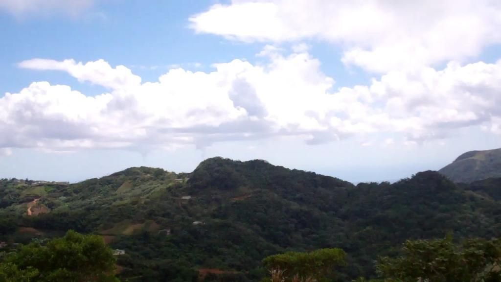 [/url]]Cordillera Central[/url] looking NNW
Gary
19 September 2017 15:34:23
1845
ReyP wrote:Looks like entering in Humacao or so?
Yeah, little bit north, Punta Santiago.
Gary
19 September 2017 15:36:42
1845

Elcalipocho
19 September 2017 16:30:08
61
Thoughts on how the western side is gonna feel this?
Gary
19 September 2017 16:38:34
1845
IF Maria will take this track the western side of the island will have tropical storm force winds.
But, keep in mind that nothing is sure until the storm is there. Hurricanes don't follow a straight line and the exact point of landfall may be clear only one hour before it's going to happen.
ravenmickey
19 September 2017 16:38:59
96
Elcalipocho wrote:Another tense 48 hours waiting
So even with this power concrete houses like mine stand a chance? I am several hundred feet above the ocean looking west next to other houses. My island friends say yes... but hard not to worry.
I was wondering the same thing a couple days ago and looked it up. Read that it's relatively safe to assume that a concrete house would stand up to the strong winds of 200 mph, flying debris, and storm surges that are produced by hurricanes. Practically, everything I read online said pretty much the same so I am hoping that there is truth to it.
Gary
19 September 2017 16:41:25
1845
Look here http://www.ssd.noaa.gov/PS/TROP/floater … -long.html
(during daylight only, this is the visible satellite image source) to see what Maria is doing. Refresh the page every half hour or so.
You see the eye wobble and that will continue to be the behavior.
This one will work day and night: http://www.ssd.noaa.gov/PS/TROP/floater … -long.html
ravenmickey
19 September 2017 16:43:05
96
Gary wrote:Track keeps shifting to the NE and I like that trend. 100 miles more and PR would dodge the bullet. (chant with me: UP! UP! UP!)
https://www.foryourpics.com/images/2017 … ue_5AM.png
I'm chanting with you! With my fingers and toes crossed!!! Updating with my family everything I am reading here seeing it's more detailed.
Sitka
19 September 2017 16:52:51
953
Gary, good links. UP UP UP!!
Elcalipocho
19 September 2017 17:03:33
61
Raven and Gary,
Thanks for the replies.
Seems like the concrete structures will be ok short of a major landslide.
Gary - you are right on the changes in direction.
Seemed like Irma was gonna destroy Tampa but luckily changed course
Gary
19 September 2017 17:40:44
1845
I need more UP UP UP!!
Track shifted back to the south west..
Sitka
19 September 2017 18:17:56
953
oh crap - UP UP UP!!
Nanraughley
19 September 2017 18:25:17
70
Up! Up! Up! Amen! Stay safe everyone. May God bless you.
Elcalipocho
19 September 2017 18:43:29
61
Up up!!!
ReyP
19 September 2017 19:02:38
5509
Time to be home or at a safe place, minor wind gusts are starting already in the east southeast area according to my family. 100% lost of power is expected according to the government, some areas are expected to lose water around 3 pm today. Some have reported already lost of water and power but this is isolated, problem is due to weak lousy infrastructure, not the storm. The island will likely become incomunicated for 3-4 days, so let family and friends know that you are fine now and not to worry. Once the winds reach 50 miles an hour all emergency personnel will be off the roads and nobody will come to rescue or help you until winds die down below that. This is a 18-24 hour event and could be longer. Stay safe.
JOS66
19 September 2017 19:06:47
78
My Wife and I are Praying for All of You and PR!!!!!
ReyP
19 September 2017 19:42:04
5509
JOS66 wrote:My Wife and I are Praying for All of You and PR!!!!!
You will be close to the eye in Dorado Jos.
Hope you are safe
JOS66
19 September 2017 19:54:15
78
Hey Rey
Have not moved yet. We are targeting for Dec / Jan.
Gary
19 September 2017 21:36:21
1845
No more maps I'm afraid, we lost internet. Maybe the power was cut at the tower. Still electricity and water.
We just finished boarding the outside windows, the three on the porch I'll do soon.
I did check the map and the track is now straight over my head..
Oh, here's the link so you guys can check yourself.  http://www.nhc.noaa.gov/refresh/graphic … k#contents
Stay safe everybody!
Gary
19 September 2017 23:17:01
1845
5PM shift back to the south west. Landfall just east of Guayama. Boarding up finished and now relaxing. Dinner on its way and it smells good. Arroz con pollo is my guess.
Sitka
19 September 2017 23:31:13
953
Latest update at 5PM shows the eye to go out of PR to the NW at Hatillo. Directly over our place. If the house is still there after the storm it is bullet proof.
However I expect we will have damage.
ReyP
19 September 2017 23:35:15
5509
Gary wrote:No more maps I'm afraid, we lost internet. Maybe the power was cut at the tower. Still electricity and water.
We just finished boarding the outside windows, the three on the porch I'll do soon.
I did check the map and the track is now straight over my head..
Oh, here's the link so you guys can check yourself.
Stay safe everybody!
Hope you are not staying home then
Subscribe to this topic
Articles to help you in your expat project in Puerto Rico

A land of opportunity and freedom.
The day we decided to move we were a little worry about how expensive it would be. Now we know how affordable it ...

Renting in Puerto Rico
Visiting the island many times over the years and getting to know the towns and different areas before making a ...

Paying Taxes in Puerto Rico
Paying Taxes in Puerto Rico

5 misconceptions about Puerto Rico
Playa del Condado, Puerto Rico
Purchasing property in Puerto Rico
Six yeas ago we purchased our home in Naguabo Puerto Rico (PR) in the barrio of El Duce. Some of the lessons we ...

About Work VISA
I am writing this guide to assist people understand how a work VISA is done.


Open a bank account that suits you
Discover the best international banks to manage your money securely.


"